Gesher Galicia is cooperating with the POLIN Museum of the History of Polish Jews in Warsaw on a five-year joint development project to furnish the Museum’s Resource Center with durable paper copies of historical cadastral maps from the collection of digitally-assembled images in our award-winning Map Room. In 2015, the first set of printed maps was delivered to the POLIN Resource Center for use by Museum visitors wishing to research their families’ lives in historical Galicia with the aid of the Center’s staff, library, and computer databases. The work is continuing this year.

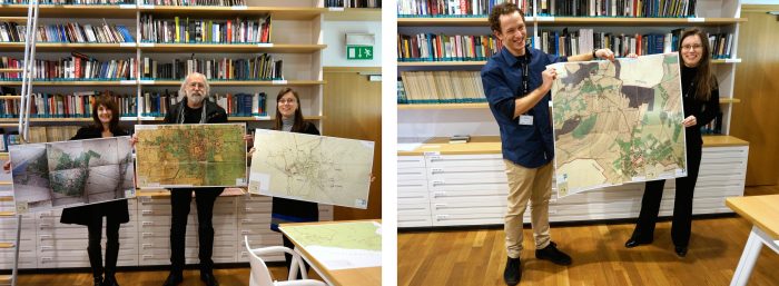
The first printed maps are held by Gesher Galicia advisers Marla Raucher Osborn and Jay Osborn, and POLIN Museum historians and Resource Center staff Magdalena Mizgalska and Michał Majewski
The historical maps form part of the POLIN Museum’s large print collection of street, regional, topographic, and other maps.
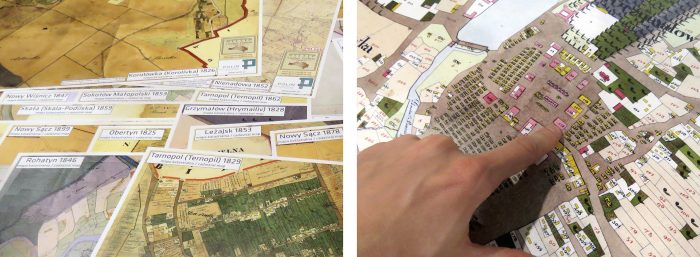
The cadastral maps were originally drafted at high scale (typically 1:2880) from very accurate Austrian Empire surveys of the 19th and early 20th century; they preserve remarkable details of the natural and man-made landscape in the entire province. The surviving historical maps cover settlements in both western and eastern former Galicia, today southeast Poland and western Ukraine. The new maps for the Resource Center are printed at near original scale, allowing visitors to investigate the individually drawn and numbered houses of their ancestors in the original context.

The 1849 cadastral map of Rzeszów, western Galicia (source: National Archive of Przemyśl, Poland), and the 1862 cadastral map of Husiatyn, eastern Galicia (source: State Archives of Ternopil Oblast, Ukraine)
Approximately 200 cadastral maps are forecast for preparation and delivery to the Resource Center over the course of project, covering nearly all of Gesher Galicia’s growing collection. The first phase of the project was completed in December 2015 with delivery of 45 maps to the Center; another 50 maps are planned for 2016. Project status and planning is documented on a tracking page in the Gesher Galicia Map Room.
The printed maps complement the many other learning aids available in the Resource Center for education, genealogy, and historical research. The Center is staffed by skilled historians with expertise in a wide variety of relevant historical topics. In addition to the maps, visitors have access to historical photographs of Jewish life in interwar Poland, computer databases devoted to the history and genealogy of Polish Jews, and a specialist library dedicated to the history, culture and religion of Jews of the region. In 2015, almost 6000 people visited the Resource Center to further explore themes they experienced in the Museum’s core collection, and to personally connect to the stories of Jewish life in Poland and the surrounding regions; now they have a unique opportunity to hold our historical maps in their hands and better understand who lived where in their ancestral towns.
The POLIN Museum Cadastral Maps Project is an offshoot of Gesher Galicia’s Cadastral Maps and Landowner Records Project, underway since 2007. It provides another way for family historians to access the remarkable information in these historical maps.

