Inventory of Cadastral Maps and Landowner Records held in the Przemyśl State Archive
(Archiwum Państwowe w Przemyślu)
(click on link at left to view images online)
Below is a PDF file listing all the cadastral maps and landowner records that have been digitized by the Przemyśl Archives in Poland and are available online. There may be other maps and records that are not available yet.
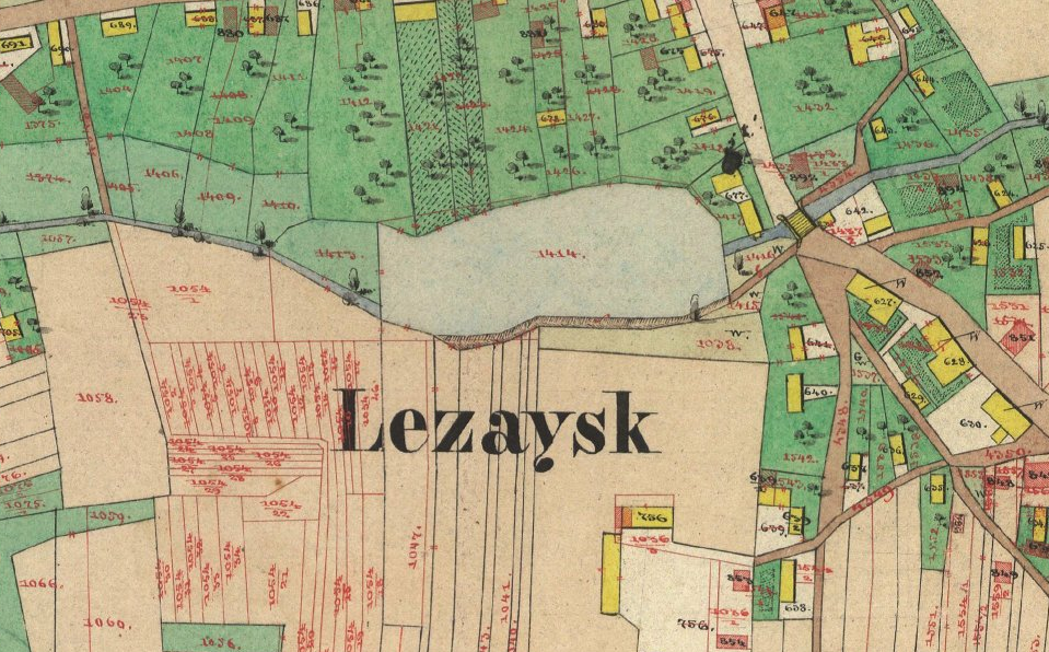
Gesher Galicia acquiries copies of these maps for our Map Room. Cadastral maps for the former Austrian province of Galicia are scattered between many archives in Poland and Ukraine, including those in Lviv, Ternopil, Przemyśl, Rzeszów, and Kraków. The maps are digitized by the archives in sections. Gesher Galicia “stitches” these components to create a single large-scale, high-resolution map, which we make available online.
To find your town just scroll down to search alphabetically, or search by clicking on the magnifying glass icon and entering the name. Maps appear to be listed first, followed by landowner records. (Cut and paste the text into Google translate to understand the terms.)
Remember that cadastral maps and landowner records for the former Austrian province of Galicia are scattered between many archives in Poland and Ukraine, including (but not limited to) those in Lviv, Ternopil, Rzeszów, and Kraków. This page just provides information on a single archive in Poland. If you don’t see your town here – or even if you do – there may be other maps in other repositories. These maps are primarily full color cadastral maps, but may have only parcel numbers, not house numbers or residents’ names. Other archives may hold maps that will pertain to your research.
The difference in viewing maps digitized by the archives, as opposed to viewing maps in the Gesher Galicia Cadastral Map Room, is that the archive adds a watermark and displays pages in sections. You cannot see the entire map. Gesher Galicia “stitches” the components together to create one large-scale, high-resolution map that is better suited to genealogical research. To view our hi-resolution complete-town maps click here.
 Loading…